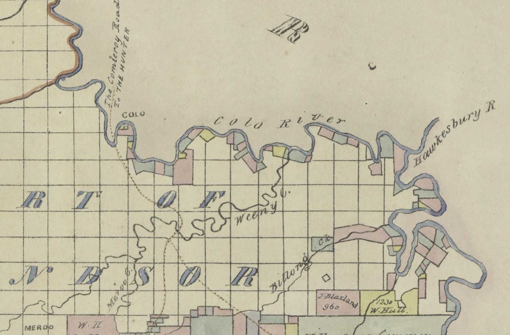
This map of the County of Cook was drawn some time between 1834 and 1846. The coloured land grants are still recognisable today and can easily be mapped to current DP and Lot numbers. Click on the button below to see the full size map in the National Library catalogue.
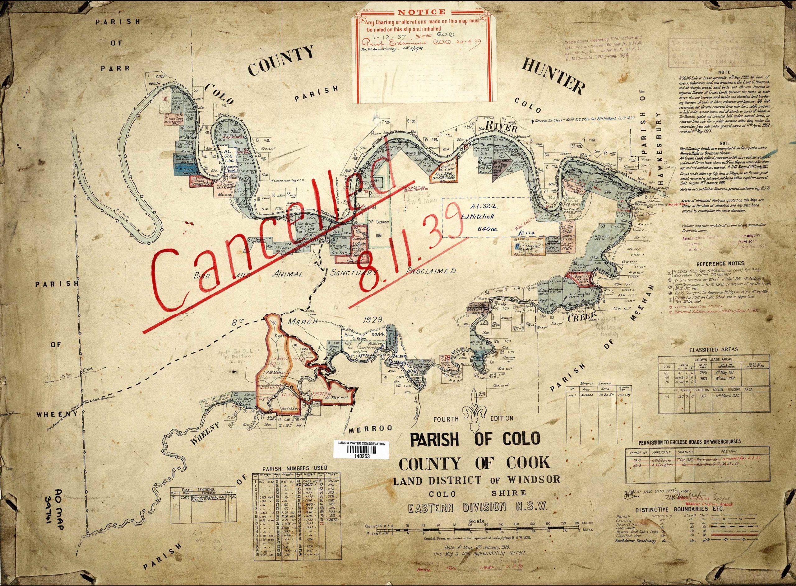
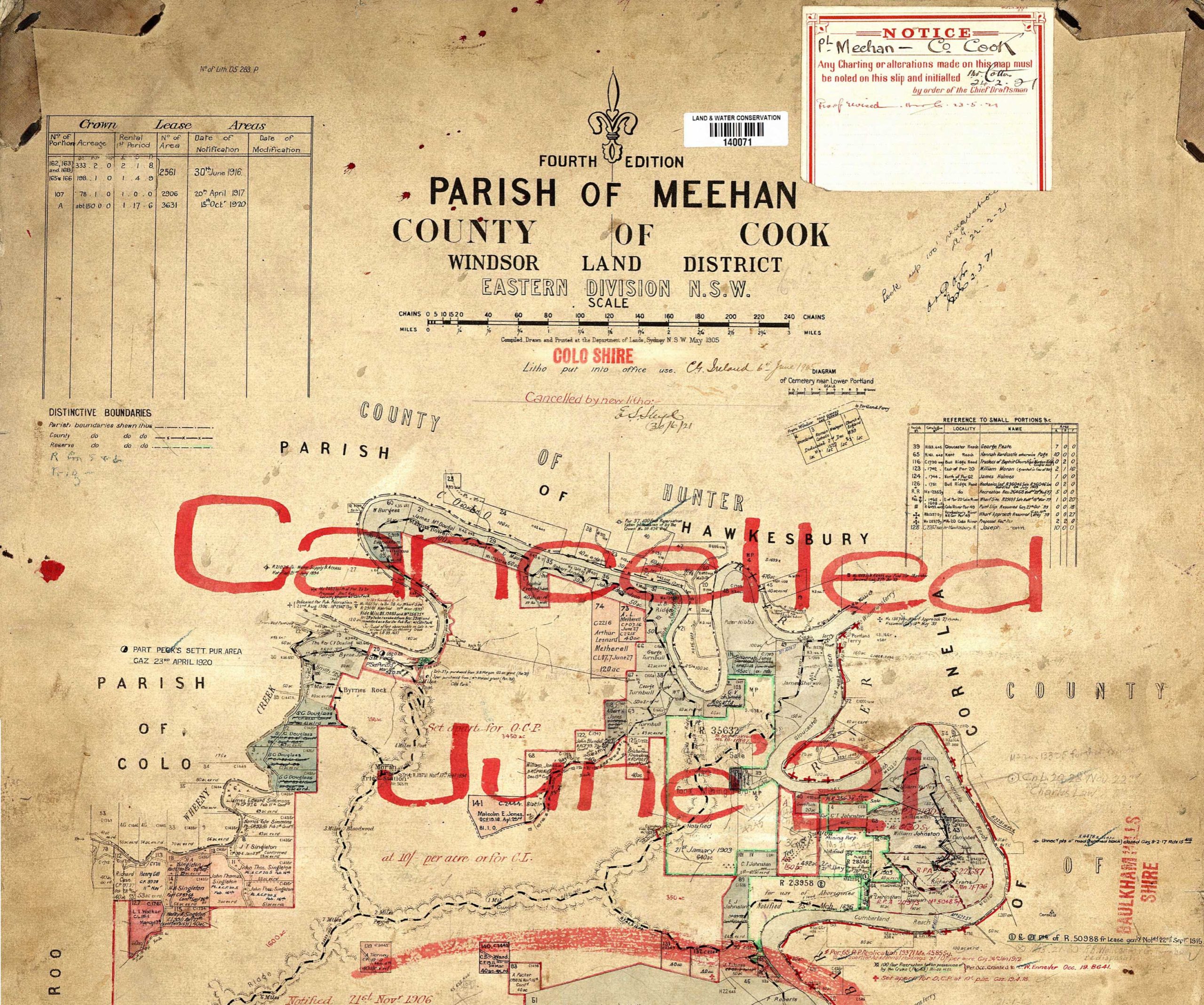
The settled part of the Colo was divided into two Counties. The County of Hunter on the north side of the river and the County of Cook on the south side. There were two Parishes within this area. The Parish of Colo was upstream on Wheeny Creek and the Parsh of Meehan was downstream of Wheeny Creek.